The point you measure in the field shows up in the office seconds later.
The GeoMarco Sync app connects the Alpha 40's DiMap Pro to QGIS. No exporting, no emailing files and no subscription fees.
Three reasons to work with the Alpha 40
Measure without levelling the pole
Tilt compensation (IMU) corrects the position up to 60° of tilt, with no initialisation: just walk a few steps. Measure wall corners, leaning posts and spots where the pole can't stand upright, without chasing the bubble.
Measure at a distance with the laser
The built-in laser, with a calibrated optical sight, measures points up to 50 m away without walking there (3 to 5 cm at 10 m): a building corner, a marker across a stream, the corner of a fenced property.
Field and office connected, no subscription
With the GeoMarco Sync app, every point, with its RTK quality and photo, reaches QGIS in near real time. The app and the plugin are free: no monthly fees, no per-user licences.
How it works
Data always flows one way, from the field to the office. The app only reads DiMap Pro projects and never changes anything on the controller.
- 1/4
Measure in DiMap Pro
The crew works as usual: points, codes and photos on the Alpha 40 controller.
- 2/4
The app sends what changed
GeoMarco Sync detects new points and uploads them every 30 to 120 seconds. With no signal, it queues them.
- 3/4
It lands in your Google Drive
Projects stay in the company's own Google account, in a GeoMarco folder. They never go through our servers.
- 4/4
Open it in QGIS
The GeoMarco plugin loads the points in PT-TM06 with code, precision, FIXED or FLOAT status and the photo of each point.
Demo
A real survey, from the controller to QGIS (1 min 19 s).
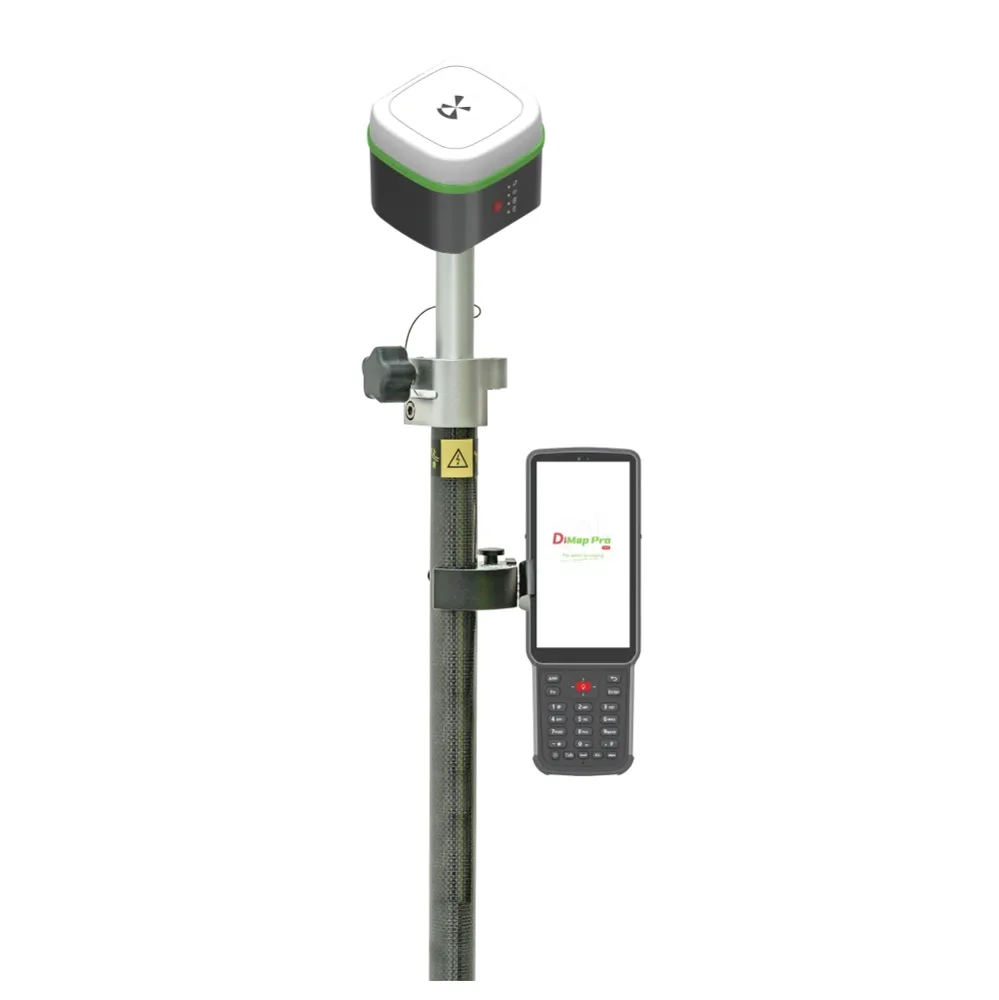
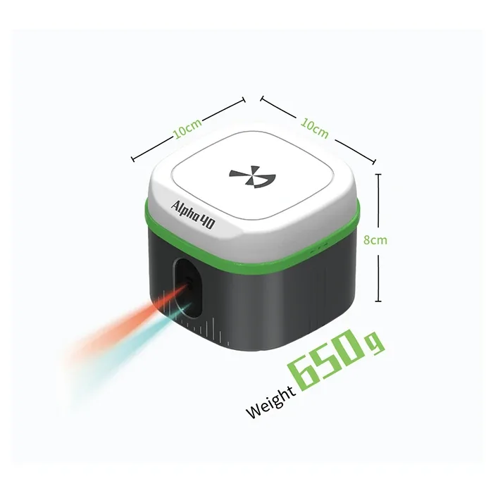
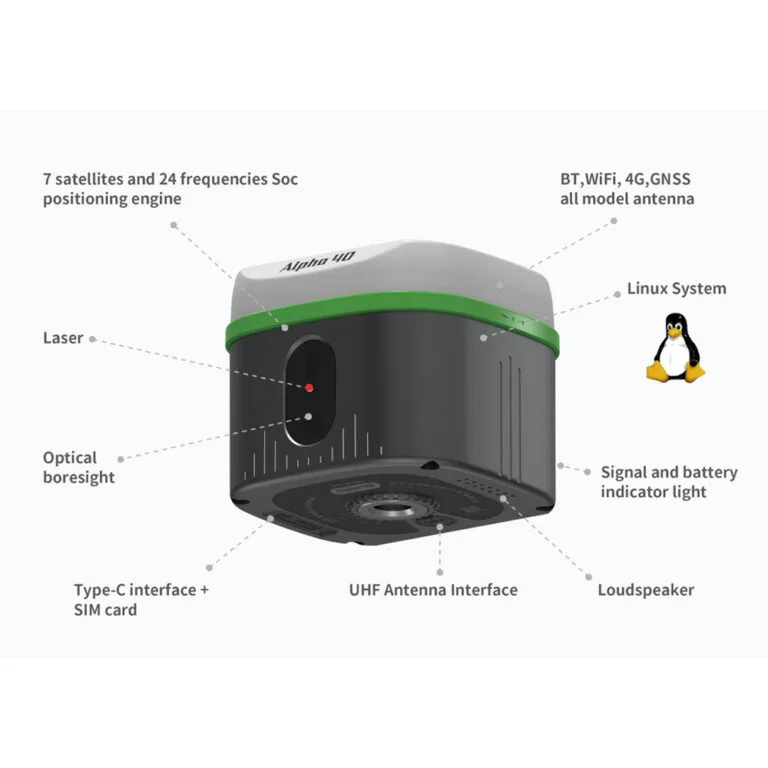
Alpha 40 with DiMap Pro
GNSS RTK receiver with IMU, laser and cameras for augmented-reality stakeout. Sold and supported in Portugal by Map3Dpro.
| Signals | 1408 channels: GPS, GLONASS, Galileo (incl. E6), BeiDou (incl. B2b), QZSS, NavIC |
|---|---|
| RTK accuracy | H ±(8 mm + 1 ppm) · V ±(15 mm + 1 ppm) |
| Tilt | 0.015° IMU, compensation up to 60°, ±(8 mm + 0.3 mm/°), no initialisation |
| Laser | 50 m range (rangefinder ±1 mm); point at 10 m within 3 to 5 cm |
| Communications | 4G, 2 W UHF radio, Wi-Fi, Bluetooth 5.2 |
| Battery | 37 Wh, up to 18 h on NTRIP |
| Ruggedness | IP67, 1.8 m drop, −30 °C to +70 °C, 650 g, 10 × 10 × 8 cm |
| Controller | 5.5" Android with DiMap Pro |
Install
Launch phase: the app and plugin are being rolled out to Map3Dpro customers. Request access and we'll send everything with the installation guide.
GeoMarco Sync app
For the Alpha controller (Android 8 or later, with a Google account). Pick the DiMap Pro projects folder once and the app does the rest.
[email to be defined]GeoMarco plugin for QGIS
For QGIS 3.22 or later. Sign in with the same Google account and load projects in one click. Refresh during the survey.
[email to be defined]Frequently asked questions
Are there subscription fees?
No. The app and the plugin are free. You only need a Google account for Drive; the free account includes 15 GB, enough for many surveys with photos.
Where is my data stored?
In your own Google Drive, in a GeoMarco folder created by the app. Data goes from the controller to Drive and from Drive to QGIS, without passing through GeoMarco servers. The app can only access the files it creates.
What if there is no signal in the field?
Points wait in a queue on the controller and are sent when the connection returns. Nothing is lost, and photos can be held for Wi-Fi.
Which equipment does it work with?
The Alpha 40 with DiMap Pro software. In the office, QGIS 3.22 or later on Windows, macOS or Linux.
Can I edit the points in QGIS?
The synced layer is read-only because it is replaced on every refresh. To work on the data, save a GeoPackage copy and draw polygons snapping to the points.
Contact
Questions, access requests or a demo with your own equipment:
[email to be defined]